Ohio Maps Home > Ohio Map Collection > Northeastern Ohio Map
Highway Map of Northeastern Ohio
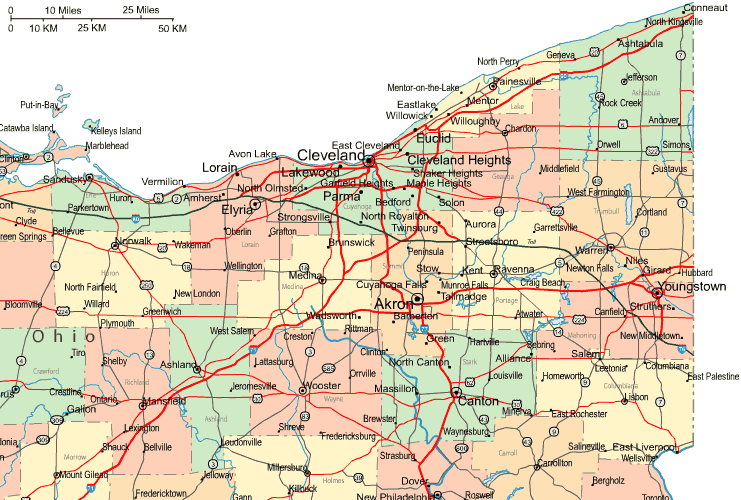
This map image is a basic drawing displaying the spatial relationships of this area with a basic selection of elements.
You are granted permission to store this web page and work with it for a variety of purposes. Providing a link to here would be awesome.
On the assumption you call for help acquiring a map, a particular map, or call for a first-rate tailor-made production, I suggest you contact us.
Buy good custom-built maps from us. A custom map made by us contain a wide combination of map components, for example: roadways, map projection, coordinates, beaches, marine navigation features, seas, falls, or recreational sites, etc. Map types reach from road to navigational, printable to printed, county level to ZIP code tabulation areas.
First-Rate maps are clear, all-inclusive, and not obsolete. Fine map-making by YellowMaps.
To acquire paper maps, such as navigational charts, attractions maps, or wilderness maps, I suggest you explore our map store We hold more than 100,000 maps.
Maps are beautiful.
Back to Ohio map collection