Ohio Maps Home > Ohio Map Collection > Northwestern Ohio Map
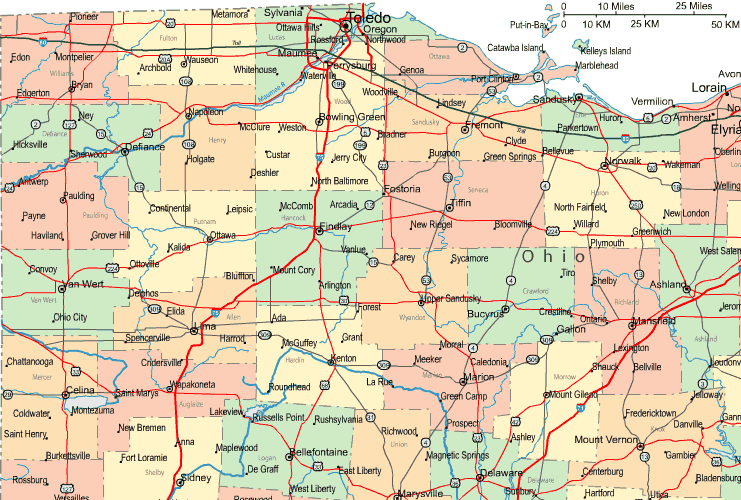
Highway Map of Northwestern Ohio

On top you have a basic sketch brandishing the geography of this scene with a classic assortment of details.
You can use this web page and utilize it in your projects. Giving credit to this source would be awesome.
On the assumption that you need support finding a map, a distinct kind of map, or need a good made-to-your-specs map, quickly contact us.
Acquire first-rate personalized maps from us. Cuztomized maps by YellowMaps cover a huge selection of elements, for example: trails, legend, GPS coordinates, district municipalities, lakes, sea features, district municipalities, or rapids, etc. Map types range from physical to satellite, printable to printed, global to consolidated cities.
Good maps are meticulous, all-inclusive, and not obsolete. First-Rate map production by YellowMaps.
To procure printed maps or charts, for example recreation atlases, maps for kids, or topographic maps, you can go to our map shop We have a collection of thousands and thousands products.
When in doubt, just ask us. We answer emails quickly.
Back to Ohio map collection