Ohio Maps Home > Ohio Map Collection > Columbus Map
Road Map of Columbus
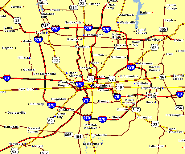
This image is a simple drawing showcasing the geography of this region with a basic selection of features.
Of course, you can download this file and use it for many purposes. Citing this page is very much appreciated.
If you need support obtaining a map, a different kind of map, or need a nice customized production, you can contact YellowMaps.
Purchase nice tailor-made maps from us. A custom map made by us cover a refreshing combination of elements, like: roads, map projection, coordinates, caves, major municipal/district areas, seas, craters, or rapids, etc. Types of maps run from topo to blank, large-print to small-print, counties to congressional districts.
Nice maps are specific, all-encompassing, and not obsolete. Expert map production by YellowMaps.
To buy physical maps, for example recreation atlases, maps of continents, or maps for kayaking, simply dive into our online map shop You can find more than 100,000 products.
Whatever map you need, just contact us - we usually respond right away, or within a few hours.
Back to Ohio map collection