Ohio Maps Home > Ohio Map Collection > Canton Map
Road Map of Canton
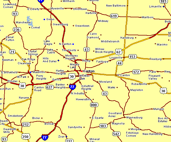
The map above is a basic depiction that lays out the layout of this neighborhood with a simple selection of map elements.
You have permission to print this web page and employ it in your research. Linking back to this resource is our request.
If you want assistance getting a map, a particular map, or want a great custom-built cartographic design, please contact YellowMaps.
Order good customized maps from us. Cuztomized maps by YellowMaps have a useful selection of details, such as: backroads, scale bar, UTM coordinates, capes, indian reserves, villages, glaciers, or recreational sites, etc. Types of maps vary from historical to contour, travel to research, census tracts to urban areas.
Great maps are clear, current, and not deceptive. Detail-Oriented map-making by YellowMaps.
To buy paper maps, like recreation atlases, state maps, or maps for kayaking, you can browse our online map shop We hold thousands and thousands items.
Cartography is so much fun. Just sit back in your chair and travel states, provinces, and countries, and never even move a leg. Who doesn't like that?
Back to Ohio map collection